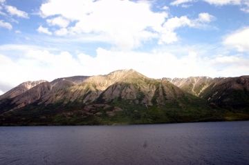
Tutshi Lake

Park Amenities:
The South Klondike Highway follows the north eastern shores of the lake for about 10 kilometres. There are various pull out viewpoints along the road for viewing the lake and the surrounding mountains. The best viewpoint is at the 70 Kilometre Marker on the South Klondike Highway.
At the south end of the lake is a day use recreation site. It is located at the 65 Kilometre Marker of the South Klondike Highway. There is a short gravel access road on your left when traveling from Carcross that leads down to the recreation site. The site includes a boat launch and a small picnic area. Near the Tutshi River Inlet are some wilderness campsites.
The main boat launch provides access to the lake for small boats and canoes. The lake is a popular destination for fishing, boating and multi day canoe paddles. Fishing in Tutshi Lake is for Arctic Grayling and Lake Trout. Fishing in the Yukon requires a fishing licence.
The oligotrophic lake is a cold lake (clear lake with low nutrient content and high oxygen levels). It is part of a chain of lakes that lead to the Yukon River. The lake first empties into the Taku Arm of Tagish Lake then connects to Marsh Lake which connects to the Yukon River.
Tutshi Lake falls within two different eco systems. The top horizontal section of Tutshi Lake is in the Boreal White and Black Spruce biogeoclimatic zone. The south vertical end of the lake is in the Spruce-Willow biogeoclimatic zone.
Explore Tutshi Lake near Carcross, Southern Lakes, Yukon Territories, Canada
Address:


