Bove Island Lookout

Park Amenities:
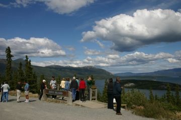
The lookout platform is easily visible from the highway. There is a small pull out parking area, interpretive signs and a large wooden platform with rails and benches. The interpretive billboards explain the history of the region and assists in identifying local landmarks.
The Windy Arm of Tagish Lake was once part of a historic paddle route during the Yukon Gold Rush. Miners would arrive in Skagway, Alaska, USA and hike the Yukon Pass to Bennett Lake. From Bennett Lake miners would paddle Nares, Tagish and Marsh Lakes to the Yukon River and Dawson City.
From the lookout, perched on a rocky ridge, one can enjoy views of the lake and surrounding mountains. Mountains like Mount Conrad, Nares Mountain and Lime Mountain. The lookout is a good opportunity to view a portion of this historic route exploring Tagish Lake.
Prior to the Yukon Gold Rush the chain of lakes were used by the First Nation people of the Yukon. The local First Nation tribes of the Tlingit and Tagish paddled these same waters for many years hunting and establishing trade with neighbouring villages.
In 1883 an American by the name of Schwatka was commissioned by the American Government to survey the transportation route leading to the Yukon River. Schwatka named the island Bove after a lieutenant in the Italian Navy.
Visit Bove Island near Carcross, Southern Lakes, Yukon Territories, Canada
Address:


