Bays, Beaches and a Lighthouse – Who’d A Thunk it.
I often wonder if tourism organizations really know what us travelers want? Yes, I know we all want different things. But that is my point exactly. The info centres just push one thing and that is paying attractions. Of course, some are fun and worth the price. But who wants to be always paying. The bottom line I think is that most travelers want to see wicked scenery – the best natural attraction that a community has to offer.
Manitoulin Island is a good example. When I visited the tourism office I was hinted to explore the more populated west side of the island. “There is more to do,” I was told. But the tourism office could not have been more wrong. It is as if they are so use to their beautiful coastlines, lakes, rivers, mountains that they do not even think we are interested. It is looking at tourism with blinders on. Plus the natural attractions do not pay membership fees. I would think if natural attractions were pushed there would be more time spent in a community and therefore, more time for those paying attractions they want us to see so badly.
It did not take me long to realize that my day researching the east side of the island was going to be the best scenery on my visit to Manitoulin Island. The same scenery I would of missed and regretted if I had taken the advice of local tourism. Luckily for me I have had more than enough experience with tourism info centres and know better.
My trip to the east end of the island was to include 3 natural destinations – the lighthouse near Meldrum Bay, Misery Bay Park and Providence Bay Park. All of which I had a keen interest in visiting because on the map they looked remote and where on the shorelines of lakes. I like lake scenery.
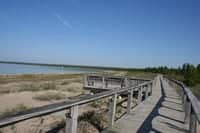
Providence Bay, near Mindemoya, was my first destination. The area was lined with cottages. There is a cute little village. The shoreline beach is long and a massive boardwalk trail follows the whole beach. The boardwalk serves as a protective barrier separating humans from the sensitive vegetation of the beach. There were viewpoints along the boardwalk with benches for looking out over Lake Huron. It was a beautiful way to start my day strolling a massive boardwalk trail with my morning coffee in one hand and a camera in another.
I arrived next in Misery Bay which is near Evansville. There was no one else in the parking lot. Hmmm. A short path led me to a nice looking interpretive centre. Unfortunately, I was greeted by a closed interpretive centre.
Luckily there was a trail map near by. To my surprise there was a good selection of trails. I planned a loop route and packed up the gear and was off. My route was going to lead me to the beach and then to a point and back.
The trails were well signed but not well used on this day. I knew as I was bumping into spider webs from the knees on up. Once I hiked through the forest I reached the beach. It was fantastic. It was a boulder beach covered in rocks. Birds flying over my head. Not a soul in sight. It was blue sky weather. It was a big smile, sore cheeks type of day.
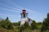
My day ended on the east point of Manitoulin Island. On the point was a lighthouse. There was a museum and a restaurant. Not sure about the restaurant though. Again there was not a car in the parking lot. Not a person to greet. I wandered around the lighthouse and took some pictures. Still no one.
There were huge slabs of elevated flat rock with big cracks (main BLOG photo) lining the point. The rolling waves would push water high up into the cracks in the flat rock. Just below me, you could see another layer of flat rock and just after that blackness. It looked like one big drop off.
It was here I sat on a boulder and enjoyed listening to the lapping of the waves, closing my eyes feeling the breeze in my face and slowly ate my very late dinner. “What a day,” I thought. Tomorrow I leave Manitoulin Island as research must move forward. I will be back fer sure. It is too nice a place not to visit again.


Leave a Reply
Want to join the discussion?Feel free to contribute!