Cascades, Waterfalls and Hikes in Mount Tremblant Park
Mount Tremblant National Park.. where to start. There are over 400 lakes, plenty of wetlands, sandy beaches, canoe routes, mountain peaks and over 20 hiking trails. For all intensive purposes I had to be selective. The best was to take a sightseeing drive and check out the park.
I set up camp on Lac Escalier. A remote campground with no power. My choice, as I wanted some quiet time. It was blissful to be hidden by trees again and wake up to birds singing instead of semi trucks, people talking and car doors slamming.
I began my exploration with a drive about. I decided to stay on the main road which was both paved and gravel. The roads I followed were called Nord 1 and parts of Nord 2. Which on the way back was Sud 1 and Sud 2. I put it together as north and south. My French was becoming intuitive or I had an eye for the obvious. Probably the latter.
I took the opportunity to stop and observe the scenery many easily accessible locations. As I wanted to save the hiking for the next day. I stopped in at Lac Monroe Service Centre (main kayak and canoe rentals), Lac Laplante Canoe Launch, Plage de la Cremaillaire (sandy beach), Rivierre de Diablo, Lac Lauzon Picnic Area of course Lac Escalier.
During my drive I had my park information with me so I could make mental notes of trailhead locations and length of trails. After some deliberation ( I hate missing good hikes) I decided I would narrow down the hikes to the ones most visited by tourists, of all ages. They tend to be shorter and I could get more of them researched during my stay.
However, there was one hike which was 14 kilometres long with an elevation gain of 500 metres, leading to peaks and waterfalls that I almost gave in to. But common sense prevailed, I stuck to the plan and narrowed it down to 4 hikes equaling a total of 10 kilometres. Better coverage, better move..
I decided to explore the Chute du Diablo, La Rouche and Le Lac Poisson Trails – a waterfall with lookout; a lookout with views of Lac Monroe and the Mount Tremblant Mountain Range; and a lake with some rock cascades.
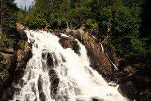
Chute du Diablo was a short 1.5 kilometre walk along a gravel, easy going path leading to a cliff side lookout. Below was the river and thundering waterfall. Not very big, only a 15 metre drop, but loud enough.
La Rouche was a lot more difficult than I expected. The description was weak. The path was gravel with some stone steps. It was a well maintained path. But what the description failed to make clear was that the trail was 2.5 kilometres straight up a hill, with only a mitt full of areas where it flattened out.
Well.. now I was excited! My legs kicked into high gear. They started to burn, but a good burn. At the 1 kilometre mark is the fork in the trail. Left goes to the lookout and right is another 2 kilometres to the cascades and Lac Poisson. I decided the lookout first and catch the cascades on the way down making it a big day.
I set in high gear. I catch up to 3 groups and move pass them. Up I go to the top, churning, telling myself the trail is flat and looking at my feet and not at the hill ahead of me. “There is a prize at the end of the hike,” I tell myself. I was determined.
I arrived at the lookout – sweaty and satisfied. I quickly set up the tripod and take out my camera gear from my backpack and started taking pictures. Soon people would be arriving and fighting for rail space on the lookout.
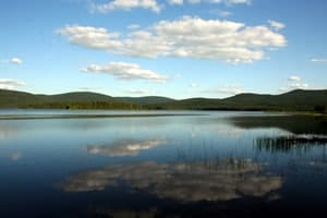
Below me was the a large portion of the park. The views were eye popping. I could see Lac Munroe, the beach and the campgrounds. In the background was the Mount Tremblant Mountain Range.
I soon spotted, up on a ridge, a viewing bench with my name on it. I sat and had my lunch. Great views, light wind and good eats. It was a clear day, a hot day, a good day. Lots of people though. Good people watching spot. All shapes and sizes, huffing and puffing. I felt like yelling, “ It was worth it, take a look!“ I walked back down the hill listening to my tunes.
1.5 kilometre down the trail I reached the cascades fork. I stood and contemplated. I asked myself was the prize going to be worth it. Should I go do another trail instead. My hunch was do it.. so I did. And I was glad I did.
The trail was a total hoot. Back to boony-bashing days through the wilderness in BC. The first part is uphill again. Testing my legs even more. But after you reach Lac Poisson and the Le Cascades sign the trail takes on a whole new look. The trail is a narrow, single track, earthy route. There are overgrown sections, mud, boulders and exposed tree roots. Some areas the tree roots and boulders combine creating stairs and bridges. At one spot there was a dead fall tree laying across the trail.
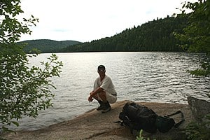
Along the way I sat on a large flat rock, so to enjoy a clear view of Lac Poisson before arriving at the Cascades. It was peaceful and no one around. I had a feeling not many used this trail. Hope the Cascades are worth it.
When I arrived the Cascades were nothing I imagined. There was no thundering white water. There were no big boulders. There was basically almost no water, just a trickle of a creek, followed by mini waterfalls, one after another. But what was unique was that the entire river rock was one smooth surface, red and moonscape like. Not a boulder or pebble to be found.
I walked up the river as far as I could go. I then turned around and headed home. It was a full day and still 3 kilometres to hike. Downhill thank goodness. No time for a canoe by the time I drive back. I planned to canoe today. But rain and clouds changed the plans. I am on the road again to my next destination.


You write very well. I feel like I was with you on that hike! Thanks! Keep it up!