North BC Parks and Places
Atlin Parks and Trails
Burns Lake Parks and Trails
Dawson Creek Parks and Trails
Fort Nelson Parks and Trails
Fort St. James Parks and Trails
Fort St. John Parks and Trails
Houston Parks and Trails
Prince George Parks and Trails
Prince Rupert Parks and Trails
Smithers Parks and Trails
Terrace Parks and Trails
Tumbler Ridge Parks and Trails
Vanderhoof Parks and Trails
Gwillim Provincial Park
Gwillim Provincial Park is popular for many who enjoy camping, hiking, snowshoeing, cross country skiing, canoeing, fishing, windsurfing, water skiing, rock climbing, wildlife viewing, horseback riding and backpacking.
Read moreHighway 29
Tumbler Ridge
Thornhill Mountain Trail
The trail and the rough gravel access road leading to the elevated views of the whole valley are by far one of the best scenic routes to explore when in Terrace,. BC hiking, off roading, mountain biking, sightseeing, xc skiing, snowshoeing, snowmobiling.
Read moreThornhill Mountain road
Terrace
Driftwood Canyon Provincial Park
The 21 hectare park is located just south of the Babine Mountains Provincial Park. In 1967 the park was created because of discovery of fossils embedded in the rock on the east side of Dawson Creek.
Read moreTelkwa High Road
Smithers
Heritage River Trails
Heritage River Trails follow the shores of the Nechako and Fraser Rivers and is popular for connecting to parks and walking , jogging, biking and sightseeing.
Read moreRiver Road
Prince George
Alaska Highway
Alaska Highway is a historic, scenic and globally recognized driving route when traveling through British Columbia, Canada and the Yukon Territories. The highway follows a scenic 2,451 kilometre (1523 mi.) paved road from Mile "0" in Dawson Creek, BC and ends in Delta Junction, Alaska, U.S.A.
Read moreAlaska Highway
Dawson Creek
Giscome Heritage Trail
Giscome Heritage Trail in Prince George, British Columbia, Canada is a designated heritage trail located north of the community of Prince George, British Columbia, Canada.
Read moreMitchell Road
Prince George
Moricetown Canyon
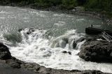
Moricetown Canyon is the home of the Wet'suwet'en First Nation people - one of the five First Nation communities located on or near Hwy 16. The main attraction is the Bulkley River, the Morice Canyon, the fish ladders and the wooden fish huts used for fishing.
Read moreHighway 16
Smithers
Dawson Trail
Dawson Trail is a year-round community walking path connecting various parks and areas of the community together. The pathway is a 4.5 kilometre route used by walkers, joggers, bikers, roller bladders and, even, golf carts in the summer and cross country skiers and snowshoers in the winter months.
Read more110 Avenue
Dawson Creek
Greer Creek Falls Hiking Trail
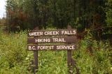
The Greer Falls Hiking Trail follows a well maintained, pine needled cushioned path for approximately 1.2 kilometre one-way to a waterfall and picnic site.
Read moreKluskus
Vanderhoof
Kager Lake
Kager Lake Trail is a year-round, easy grade trail system located at the base of Boer Mountain connecting Kager, Long and Slug Lakes popular for (hiking, mountain biking, canoeing, horseback riding, birdwatching, ATV and snowmobiles.
Read moreTintagel Road
Burns Lake
Flatbed Pools Trail
A 2 kilometre one-way path (4 kilometres return trip) leading to a series of river pools and dinosaur tracks. The hike follows a pine needle cushioned trail along a ridge, into a forest and out to three pools - The Cabin, Overehanging Rock and Top Pools.
Read moreMackenzie Way
Tumbler Ridge
Charlie Lake Provincial Park
The park rests on the shores of Charlie Lake and for years the park has provided hours of activity for many who enjoy swimming, fishing, camping and hiking.
Read moreHighway 97
Fort St. John
Rod Reid Nature Trail
The pond is an easy access route used heavily by the locals. There are dog walkers, joggers and people, every day, out for a stroll on the Rod Reid Nature Trail.
Read more9th Avenue.
Burns Lake
Oliver Lake
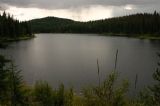
The area is a popular destination for hikers, but also for wildlife. Visiting Oliver Lake and hiking the Dwarf Forest Trail provides a good opportunity to view Bald Eagles and Ravens.
Read moreRidley Island Rd
Prince Rupert
Babine Lake
Babine Lake is located near the communities of Smithers, Telkwa, Burns Lake, and Houston. The popular lake rests next to the Babine Mountains and is the longest and largest natural lake in British Columbia, Canada spanning 177 kilometres long (110 miles).
Read moreSmithers

