Tokenatch Trail

Influencer:
Nestled between Powell River and Lund
British Columbia
Canada
Trail Length: 3.7 km one way
Difficulty: Easy - Family
Park Amenities:
Tokenatch Trail in Powell River BC
Hiking the Sunshine Coast Trail near Lund BC
Short 7+ kilometre there-and-back hiking trail leading to views over Okeover Arm
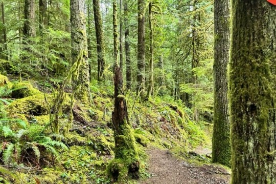
Tokenatch Trail in Powell River BC is a 3.7 km section of the Sunshine Coast Trail. It is a there-and-back hiking adventure on the lands of the Sliammon First Nation. The hiking adventure is an experience exploring rainforest sights, sounds and smells. Located on Tla'amin Lands this hike will take you through the rainforest, along boardwalks and over wooden bridges till you reach the end summit where there is a view of the Okeover Inlet.
Tokenatch Trail Camping
The campground has firepits and picnic tables making it the perfect spot to stop and have your lunch. Consequently, this section of the trail can be done as part of the Sunshine Coast trail or as a round trip day hike.
Tokenatch Trail in Powell River British Columbia Canada
Hiking the Sunshine Coast Trail near Lund BC
Address:
Tokenatch Trail
Southview Road
Nestled between Powell River and Lund
Canada
How To Get ToTokenatch Trail
:How to Get Here: From Powell River British Columbia Canada travel North on Highway 101 towards Lund BC. Turn right onto Southview Road and travel 3.5km up it till you hit the Trinket Trail. Here there is lots of parking and the trail head will be located just across the road.
No reviews yet for Tokenatch Trail.


