Tex Lyon Trail

Trail Length: 4.5 Kilometers (one way)
Difficulty: Difficult
Park Amenities:
The Tex Lyon Trail is a historical hiking trail dating back to the 1940s when the north end of the island was in a deep state of discovery. The hiking trail was a trail used by people traveling between Port Hardy and Fort Rupert, British Columbia, Canada. The trail is a little used route today which at times can be over grown. However, for the hearty hiker is is an adventure worthy of accomplishing.
 Tex Lyon Trail travels through thick forests, navigating around tides, high stepping tree roots , slogging through mud and climbing steep hill grades. The 4.5 kilometre route is considered a difficult hike because much of it is "up and down" and scrambling for foot holds and grips.
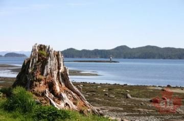
The trailhead access can be tricky to find. Depending on the season it can actually be hidden from view by the trees. When seeking out the trailhead one must keep a keen lookout for a weathered sign at the north end of Storey's Beach in Port Hardy. From the Kinsmen picnic shelter at Storey's Beach walk for approximately 20 minutes along the beach to the trailhead.
Beware of the tides. At high tides the trailhead is not accessible along the beach and hikers must climb a rock bluff to access the trailhead. At low tides hikers are able to walk around the point to the trailhead.
The Tex Lyon Trail is no easy route. After accessing the trailhead it is very likely that the trail will be slippery, muddy and cold. Prepare well for wind and rain as the trail is exposed to the unpredictable weather conditions coming off the ocean.
Address:


