Chief Whitcap Trails

Difficulty: Easy - Family
Park Amenities:
Chief Whitcap Trails
Things to Do near Saskatoon, Saskatchewan, Canada
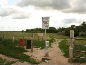
Chief Whitecap Park is a wilderness grassland park and flood plain situated on the shores of the South Saskatchewan River. The park is designed to provide a natural experience with little human development.
Chief Whitecap Park was named after a First Nation Chief who assisted the early European pioneers in selecting a location for the community of Saskatoon. Today, the park is part of the Meewasin Valley park and trail system.
 Chief Whitecap Park is a recreation area best known for its hiking trails and off leash dog areas. The park enjoys some of the best off leash areas in the region, as well as, some of the more natural hiking trails in the Meewasin Valley.
The park is signed with off-leash and on-leash areas for dogs. Please respect the on-leash hiking trails as they are areas shared with hikers, birdwatchers and sightseers.
The park is divided into two diverse sections.
The main section measures about 106 hectares (261 acres). It is mostly undeveloped land, left in a natural state, covered in forests, prairie grassland fields, flood plains and hiking trails.
The second section of the park is located in the southern end. It measures only 21 hectares (50 acres). There is an interpretive area with information signs and a native prairie grassland conservation area. Dogs are not permitted in the area.
The hiking trails in the Chief Whitecap Park are single track paths. There is a main trail which follows the banks of the South Saskatchewan River. There are some secondary trails exploring the flood plains. And the Trans Canada Trail passes through the park.
The trails closer to the South Saskatchewan River are sand trails. The trails exploring the flood plains are dirt and gravel trails. Some explore under the cover of trees while others are completely exposed to the sun while crossing grassland fields.
Address:


