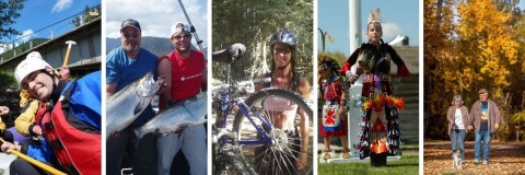
Parks and Trails in the Yukon Territory
Discover the top places to visit. - Plan an amazing adventure. - Explore the Yukon
Click the Yukon Regions below to view parks, trails and places in that area.
Best Dawson City and Carmacks, Yukon Territories, Canada parks, trails, historic sites, beaches, and places published by Canadian Travel Influencers.
Best Haines Junction, Yukon Territories, Canada parks, trails, historic sites, beaches, and places published by Canadian Travel Influencers.
Best Faro and Ross River, Yukon Territories, Canada parks, trails, historic sites, beaches, and places published by Canadian Travel Influencers.
Best Keno City and Mayo, Yukon Territories, Canada parks, trails, historic sites, beaches, and places published by Canadian Travel Influencers.
Best Carcross, Teslin and Tagish, Yukon Territories, Canada parks, trails, historic sites, beaches, and places published by Canadian Travel Influencers.
Best Watson Lake, Yukon Territories, Canada parks, trails, historic sites, beaches, and places published by Canadian Travel Influencers.
Best Whitehorse, Yukon Territories, Canada parks, trails, historic sites, beaches, and places published by Canadian Travel Influencers.
Fire Tower Lookout

The 200 foot tall Fire Tower Lookout is located on a long gravel road leading deep into the mountains near the community of Dawson City, Yukon Territories, Canada. The tower is situated at 4000 feet of Jubilee Mountain.
Read moreDawson City
Wye Lake Park

The Wye Lake Park is a recreation destination located in the heart of the community of Watson Lake in the Yukon Territory, Canada. The 26 hectare community park is a day use area visited regularly as an activity destination.
Read moreWatson Lake
Kluane National Park and Reserve

The Kluane National Park and Reserve is "THE" adventure park in the Yukon Territori, Canada. The wilderness park is a recreation destination for a mecca of year round outdoor activities. It is home to many species of wildlife, flora and fauna. It is a land full of mountains, lakes, rivers, forests,
Read moreHighway #1
Haines Junction
Liard River Hot Springs Provincial Park

Liard River Hot Springs Provincial Park is located east of the community of Watson Lake, Yukon Territory on the British Columbia side of the Alaska Highway. The park features a campground, wildlife sightings and two natural hot springs. Together they are the largest hot springs in Canada!
Read moreLiard River
Wolf Creek Trail

The trails in the area are popular for hiking, sightseeing, cross country skiing and mountain biking. There are picnic tables, a shelter, playground, many interpretive signs and 2 viewing platforms looking over the Yukon River.
Read moreWhitehorse

Chilkoot Trail

Chilkoot Trail National Historic Site is a 53 kilometre long hiking trail spanning from Skagway, Alaska, USA to Carcross, Yukon Territory, Canada. The historic hiking route was a major transportation route used by miners during the Yukon Gold Rush.
Read moreSouth Klondike Highway
Carcross
Community Trails

Community Trails within the community of Faro, Yukon Territories are popular for connecting and moving around the community by bike, foot, xc ski, snowshoe and snowmobile. The trails include the Bear, Eagle, Fox, Rabbit and Wolf Trails.
Read moreCampbell Street
Faro
Rock Glacier Trail

The 3.2 kilometre ( 2.1 mi ) hiking route follows a boardwalk, saw dust and rock slide trail leading up to the toe of the rock glacier and a viewing platform.
Read moreHaines Highway
Haines Junction
Bennett Lake

Bennett Lake is home to many recreational activities. In the summer months some of the activities enjoyed include fishing (Lake Trout and Arctic Grayling), boating, sailing, canoeing, swimming and backpacking. Backpacking is enjoyed along the shores of the lake on the Chilkoot Trail.
Read moreHighway #2
Carcross


Robinson Roadhouse Historic Site

Roadhouse Historic Site is a sightseeing destination providing insight into the history of Klondike Gold Rush and the lives of the many miners and trappers who lived in the region.
Read moreSouth Klondike Highway
Carcross
Chadburn Lake

Chadburn Lake is a day use park with recreation trails. There is a picnic shelter, canoe cabin, picnic tables, small pebbled beach and pit toilets. There is a pier and a rooftop boat launch for canoeing and fishing (no power boats).
Read moreWhitehorse
Kookatsoon Lake

The park is situated on the shores of Kookatsoon Lake. It is a small park with a beautiful turquoise-green lake. A lake which is shallow and great for swimming and launching a canoe.
Read moreHwy#2
Carcross