Umfreville Trail

Trail Length: 8 kilometres
Park Amenities:
Umfreville Trail is a recreation pathway and sightseeing route following the shores of Pelican Lake in the community of Sioux Lookout, Sunset Country, Ontario, Canada.
The Umfreville Trail is a paved pathway measuring about 8 kilometers long. The trail network is lined with large grassy lawns, lakeshore and forests of balsam, birch, spruce and white and red pine trees. Other trails like the Abram Chutes Walkway form part of the trail network.
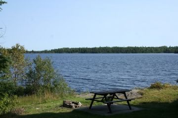
Located along the route are picnic tables, sightseeing benches and information plaques and signs. The plaques tell stories about the community, Sioux Mountain, the local First Nation people and the local historic sites.
Some of the more popular destinations and views enjoyed while exploring on the Umfreville Trail include First Sandy, Second Sandy, Floatplanes, Frog Rapids and an old radar station.
The sightseeing route is a popular summer destination for walking, hiking, jogging, biking, dog walking and rollerblading. The trail is a wheelchair and baby stroller friendly route. The trail also links to the Trans-Canada Trail.
During the winter months, after the snow has fallen, the trail becomes a cross country ski and snowmobile route.
The winter version of the Umfreville Trail links to the Northern Ontario Snowmobile Trail. The trail network connects Sioux Narrows with some of the other villages in the region.
The Umfreville Trail follows along the same route as Highway #72. The northern trailhead is located near the Chamber of Commerce in town and the southern terminus is located in Umfreville Park Historic Site and near Frog Rapids.
Located in the Umfreville Park is a National Historic Site honoring Edward Umfreville. The site celebrates the 1784 discovery of a canoe route connecting Lake Superior with the western regions of Canada .
Umfreville Park is located on the shores of Abram Lake. The park enjoys a day use picnic area with some excellent lake side picnic tables.
Explore Umfreville Trail, Sioux Lookout, Northern Ontario, Canada, Sunset Country
Address:


