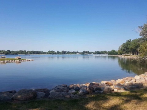
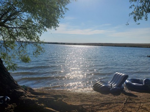
window.dataLayer = window.dataLayer || []; function gtag(){dataLayer.push(arguments);} gtag('js', new Date()); gtag('config', 'G-P7XXP1DQDD');

South Alberta Parks & Trails

hoodoos20090622_621
Hoodoos (aka fairy chimneys and earth pyramids) are tall rock pillars created from soft sedimentary rock (sandstone) topped with a harder rock which is more resistant to time and the elements like wind and rain.
Read more
Drumheller
birds20090626_10
Some of the waterfowl sightings in the Frank Lake area include Northern pintail, Lesser scaup, Ring-necked duck, Canvasback, Green-winged teal, American wigeon, Northern shoveler, Bufflehead, Ruddy duck, Snow goose and Tundra swan.
Read more
High River
lakefront-path-02
Townsite Trail is a paved community pathway which explores the village of Waterton and visits with Emerald Bay (Divers Bay) and Cameron Bay on the shores of Upper Waterton Lake.
Read more
Waterton
path-boathouse20090618_280001
Some of the summer activities enjoyed in the Echo Dale Regional Park include swimming, hiking, canoeing, birdwatching, picnicking and lounging around on the large grass lawns.
Read more
Medicine Hat
george-moss-park-sign---ogden---se-calgary-ab
George Moss Park is an urban community park in the SE community of Ogden, Alberta, Canada near Calgary. Green space, mature trees, and a new basketball court make this park a great neighborhood meeting place.
Read more
74 Avenue SE Calgary Alberta
Ogden
entrance20090624_77
The community park is a green-space park with large grass lawns, rock and flower gardens surrounded by trees and recreation pathway.
Read more
Brooks
canyon20090520_840001
Red Rock Canyon Trail is one of the most visited sightseeing destination trails in the Waterton Lakes National Park located in the southwest corner of the province of Alberta, Canada.
Read more
Waterton
paths-sask-river20090615_200001
This Medicine Hat, Alberta, Canada park is part of a flood plain and is identified as a riparian area with a sensitive eco system. At one time the parkland was a NWMP (North West Mounted Police) outpost monitoring the fur trade and policing whisky.
Read more
Medicine Hat
birds20090630_55
Discovery Ridge is a residential neighbourhood in the southwest region of Calgary. It is located on the western ridge of the city bounded by Glenmore Trail, Elbow River, and Tsui T’ina
Read more
160 Discovery Ridge Blvd
Calgary
renfrew-park-86
Children Community Playground
Read more
811 Radford Rd NE, Calgary, AB T2E 0R7
renfrew
lake20090520_400001
The Akamina Lake Trail measures about 1 kilometre (return) and enjoys little, if any, elevation gain. The route begins from Cameron Lake. It is a suitable walking route for all ages and abilities, however, it is not wheelchair friendly.
Read more
Waterton
lake20090625_45
The pathway in the Sunshine Lake area, the lake itself, the large sprawling grass lawns, the sightseeing benches and the Happy Trails Pathway provide an opportunity for many activities in High River, Alberta.
Read more
High River
beach20090624_61
Kinbrook Island Provincial Park was not established as a provincial park until 1951. Next to the park is the Kinbrook Marsh. It is one of three marshes on Lake Newell along with the Sven Bayer Peninsula and Pelican Island.
Read more
Brooks
table-mountain-views-alberta-canada
Table Mountain is a 10km in and back summit hike in Castle Provincial Park. Located in southern Alberta. This hike/scramble takes about 3-5 hours to complete depending on skill level.
Read more
49.3647511, -114.2991098
Beaver Mines, Alberta
fountain20090615_870001
Riverside Park is a veterans memorial park easily located next to the Medicine Hat, Alberta City Hall. The park includes a cenotaph, monuments, some art work and a water fountain.
Read more
Medicine Hat

Alberta Park Adventures

South Alberta Adventure Stories